For some reason when I pictured and planned for this trip, one of the places that I was looking forward to the most was Southern Utah. The primary reason I gave people for this is that it is jam-packed with incredible sites; it is home to the Mighty Five national parks (which rank in the top most iconic, not to mention most visited, of the parks in the whole NPS system), as well as quite a lot of other national monuments, recreation sites, historical preserves, and more. But I think the appeal for me was also tied to the fact that the desert is basically the inverse of where I grew up, and landscapes I am familiar with. It’s like it’s a different planet, and it’s breathtaking in its beauty and variety – I can see how people so easily fall in love with this place.
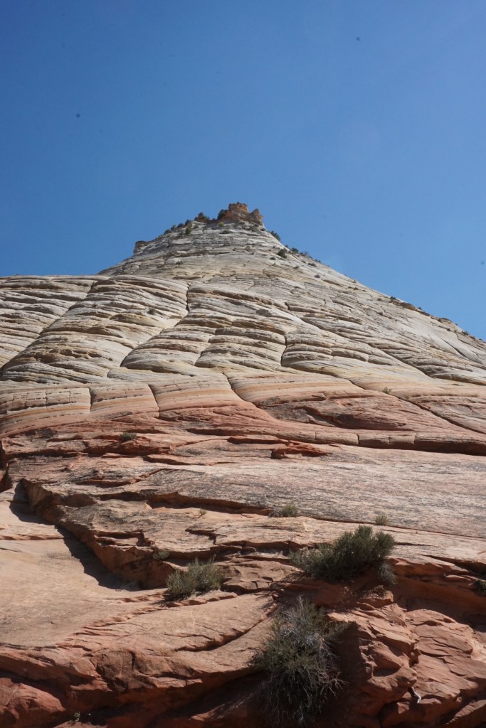
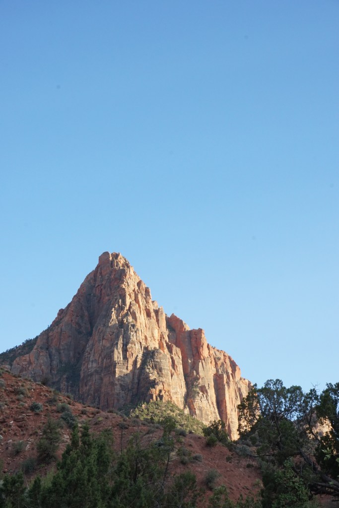
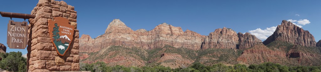
Zion National Park
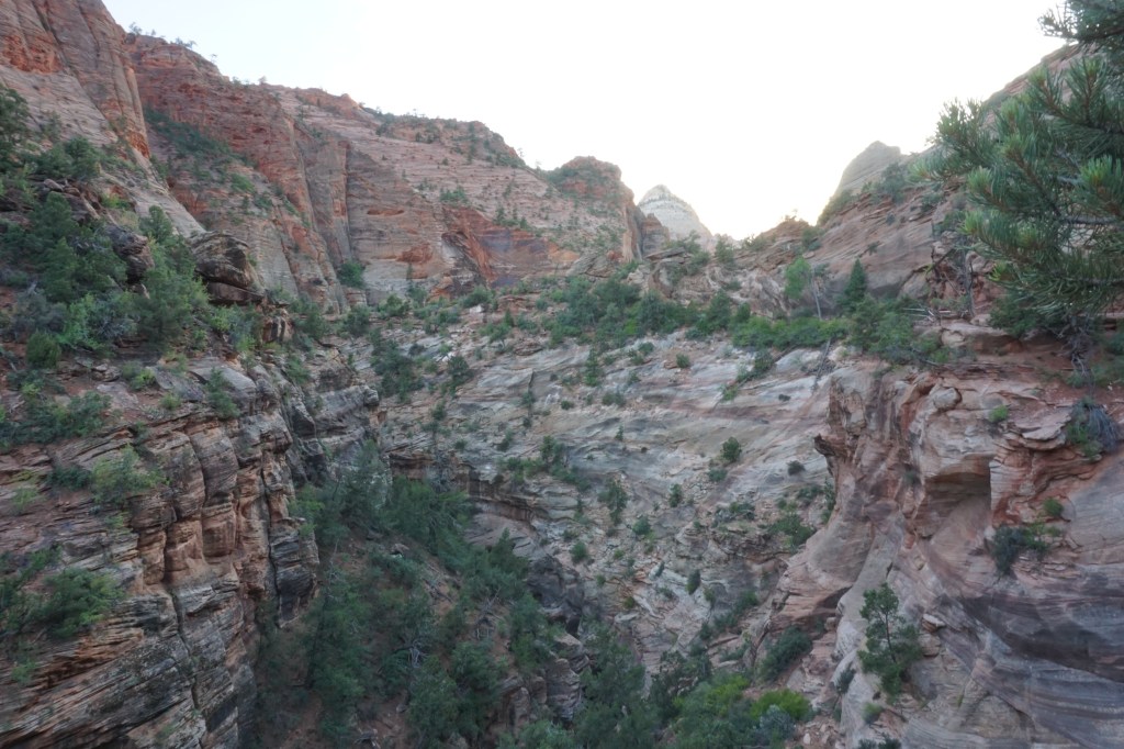
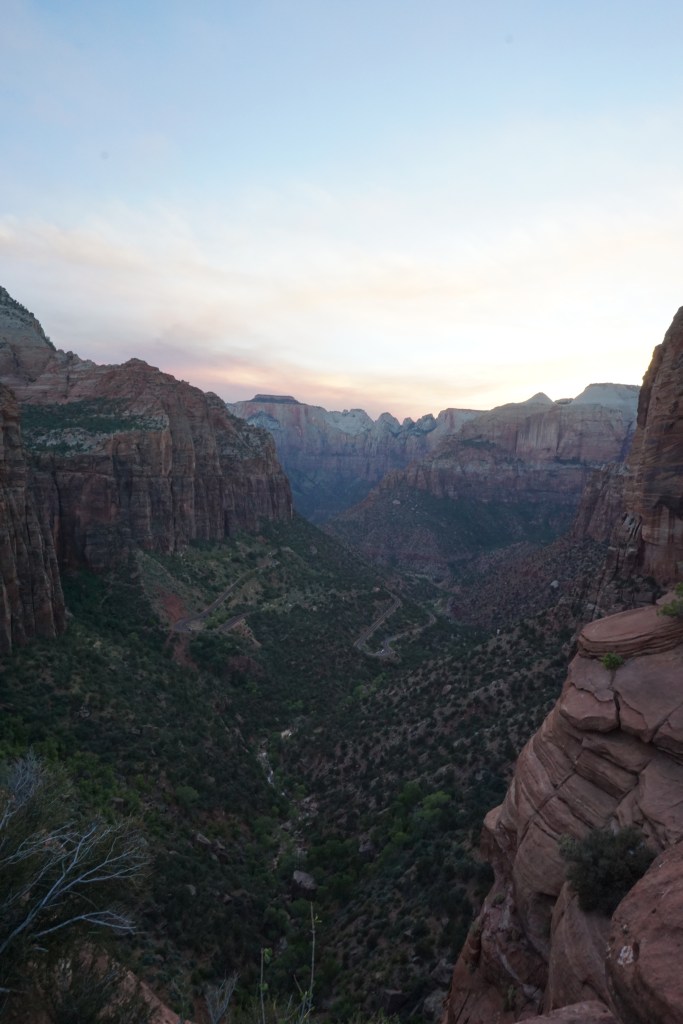
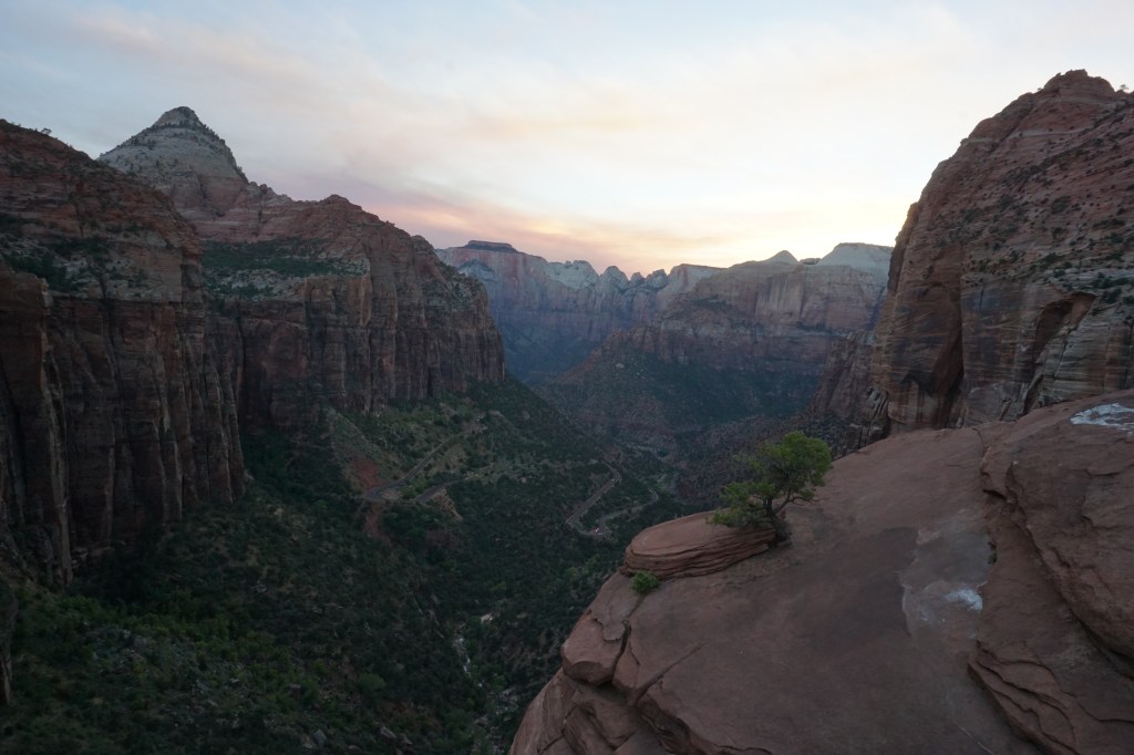
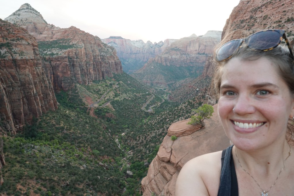
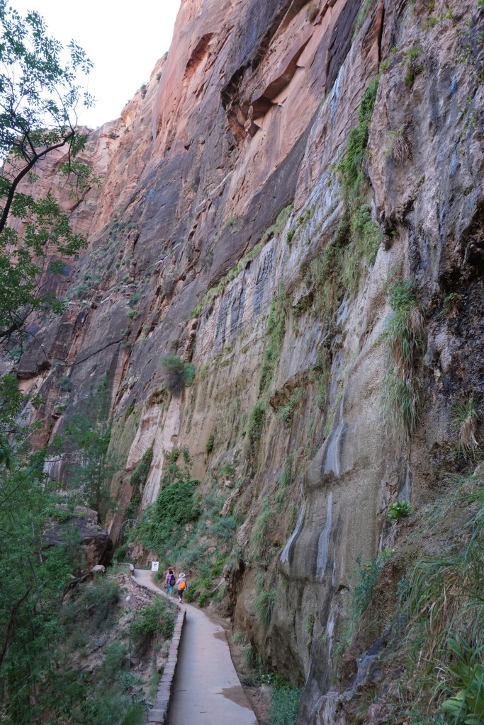
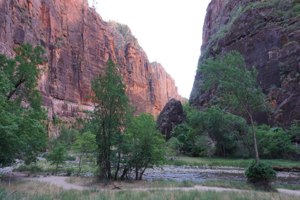
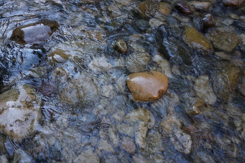
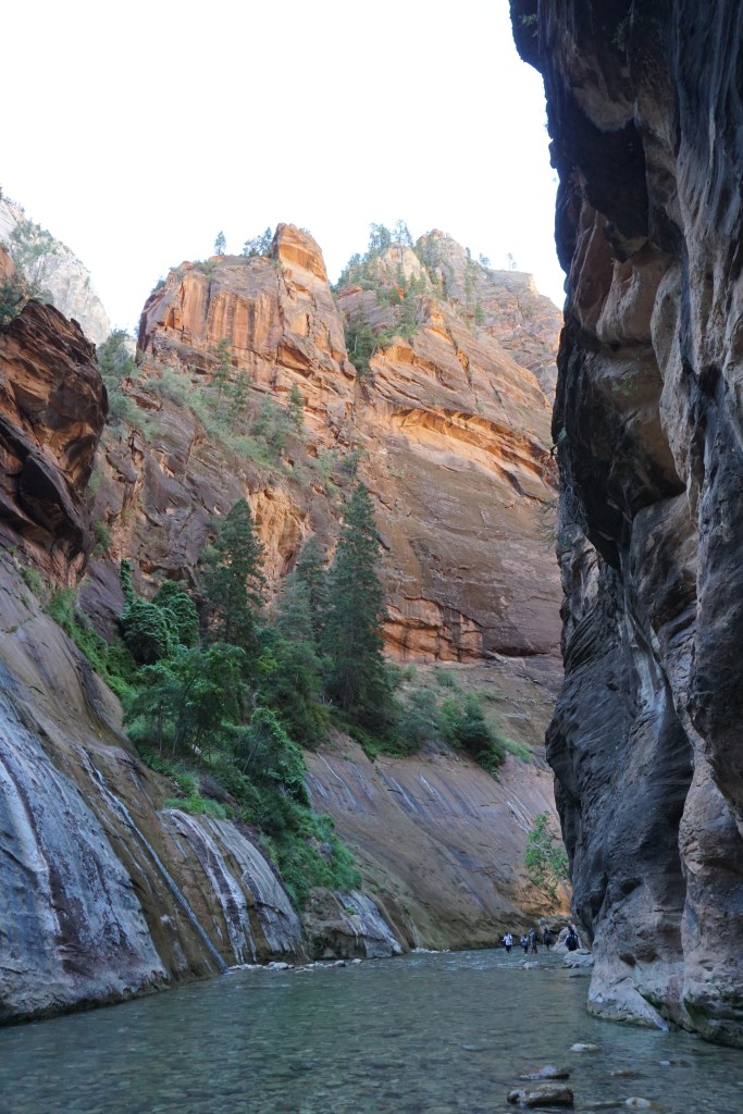
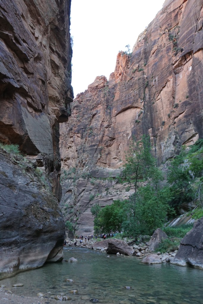
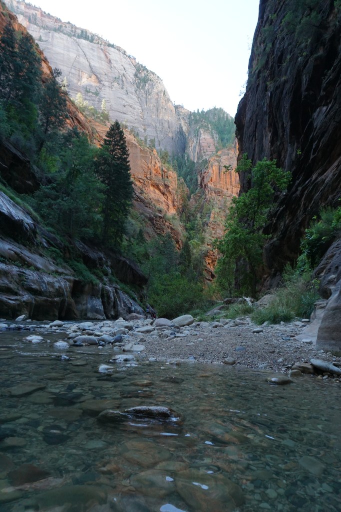
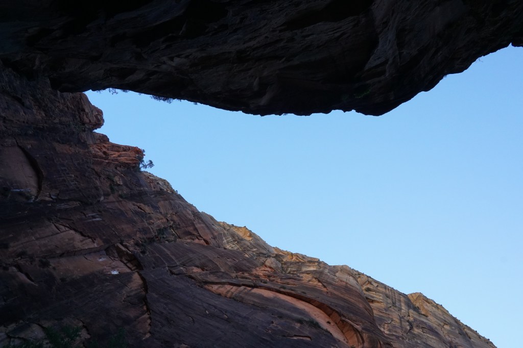
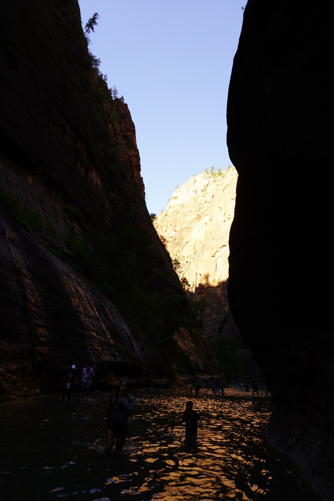
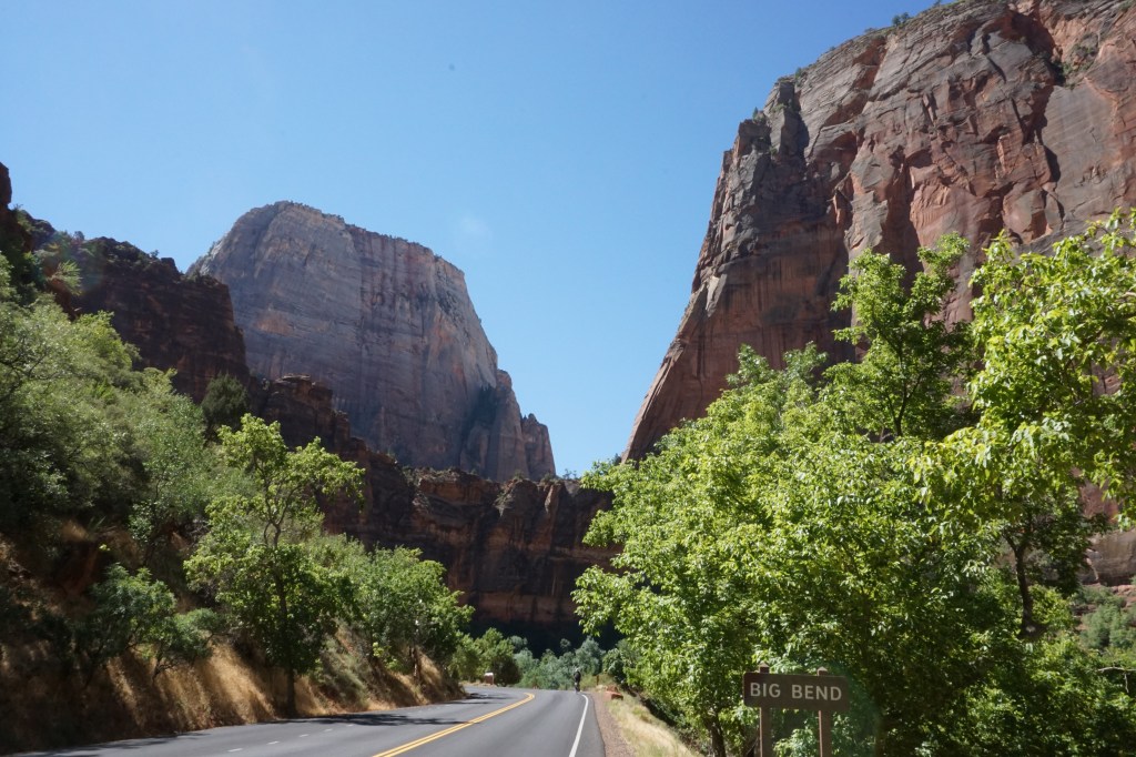
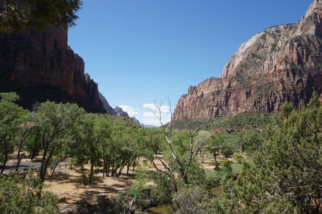
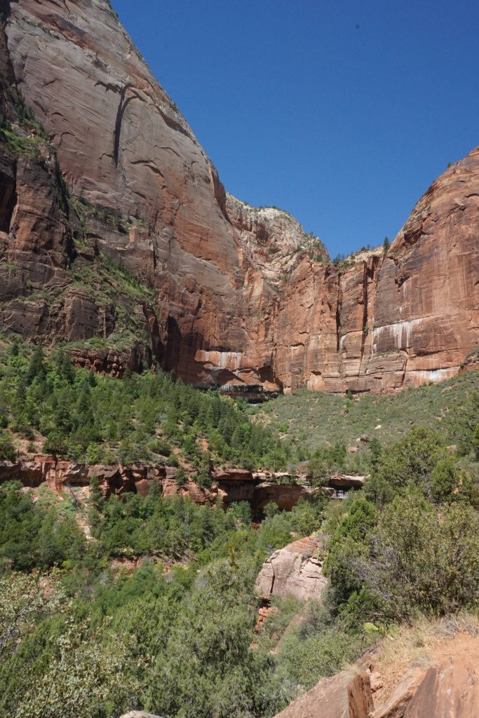
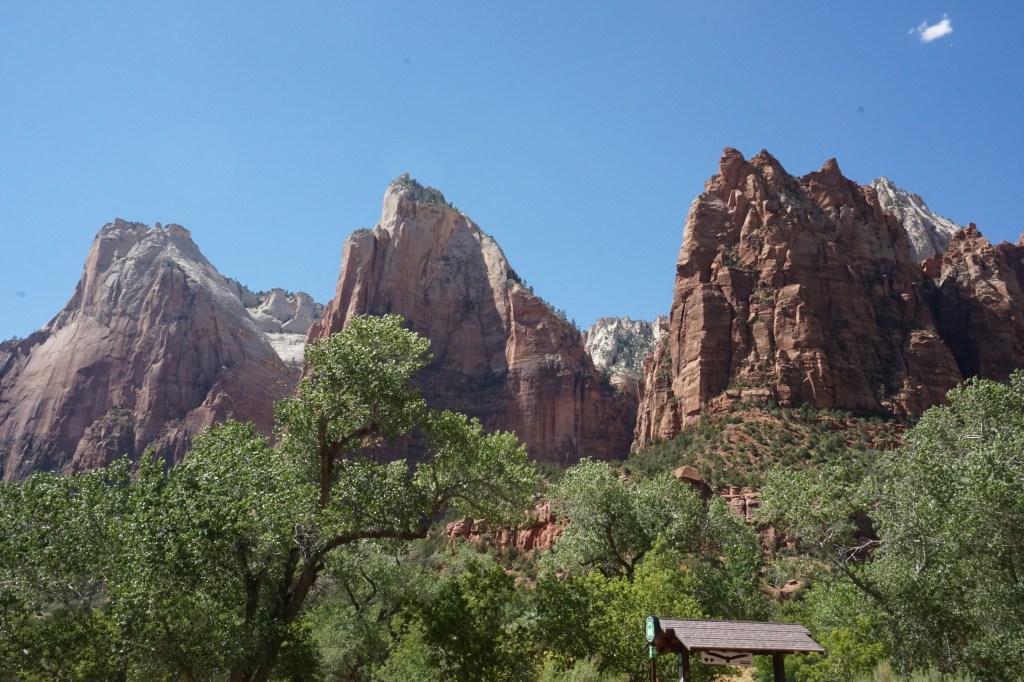
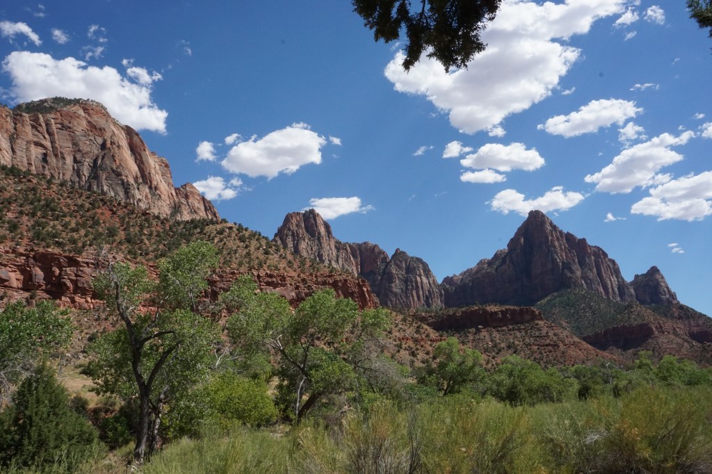
The whole time I lived in Southern California, I planned to take a weekend trip to Zion and never made it; I’m so glad I can finally cross it off my bucket list. It’s home to some iconic views and hikes, including one I got to experience: The Narrows – a hike where the trail literally IS the river, where you walk through water that can be at times waist deep. Most other people rent special water hiking boots and poles in town, but I thought I’d be fine with my regular hiking boots and trekking poles – and I probably would have been, if I hadn’t forgotten the poles in my car! I gave it a go anyway, knowing I probably wouldn’t make it that far, and I didn’t, since as you go the canyon gets narrower, and the water gets deeper and the current gets faster – which made it harder to continue safely without poles to stabilize myself. I’m not really sure how far I made it, but I think probably about a mile or so. Maybe some day I’ll go back and trek the full five miles up into the campsites at the end of the canyon.


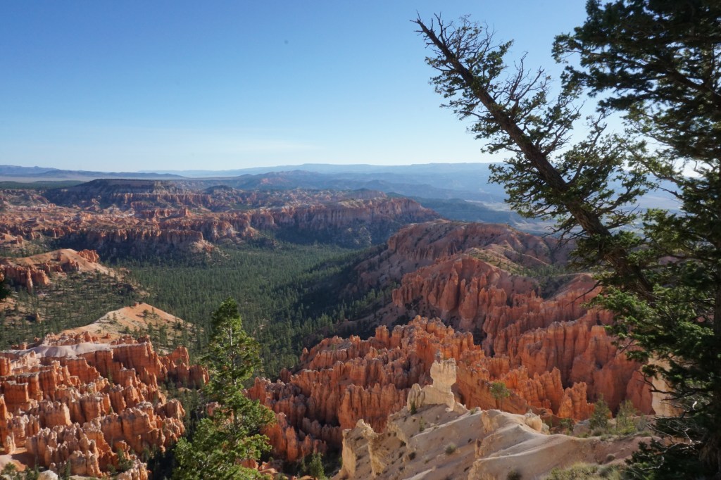
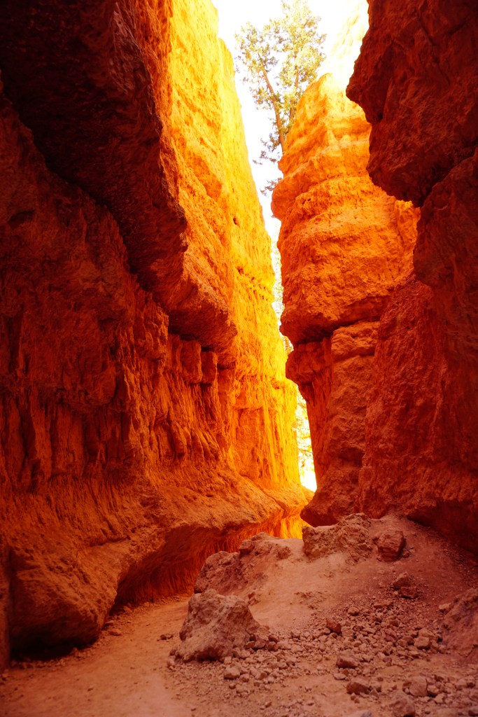
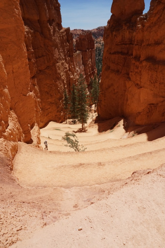
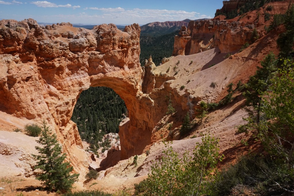
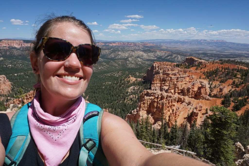
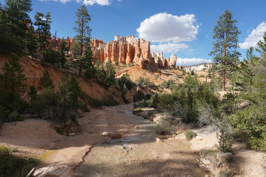
Bryce Canyon National Park
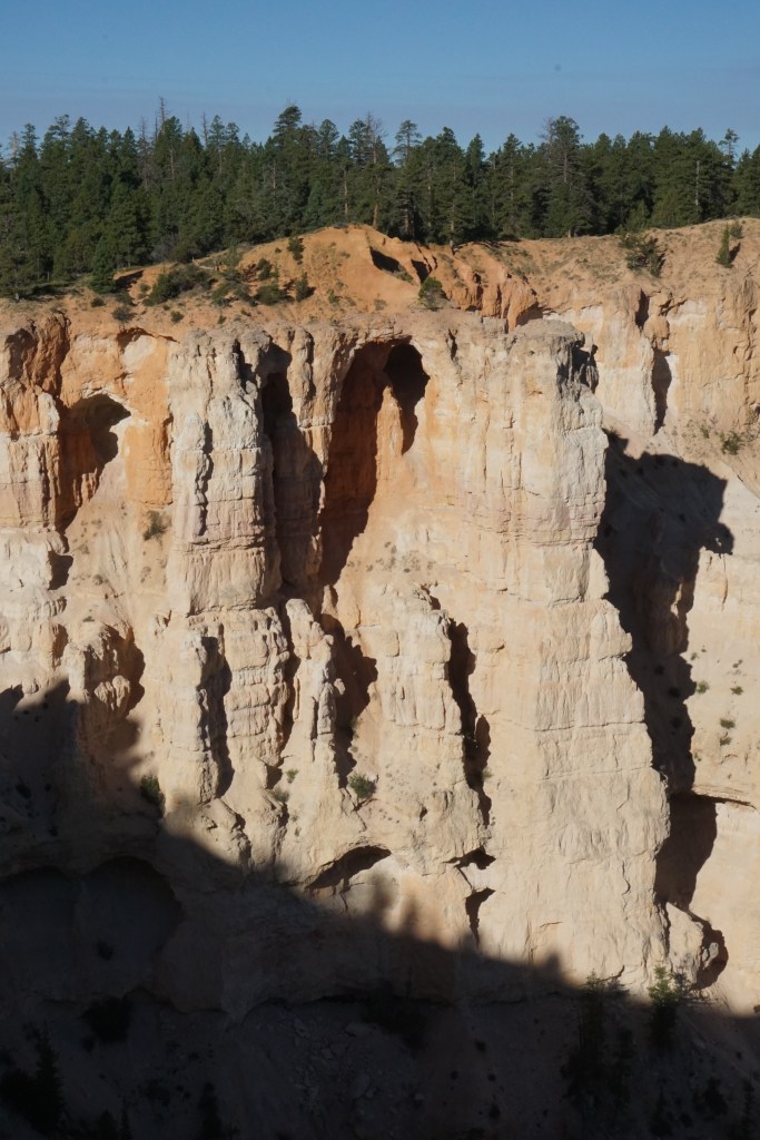
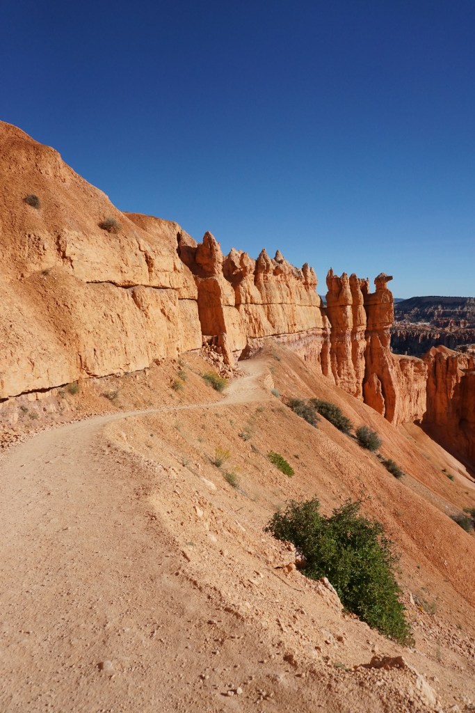
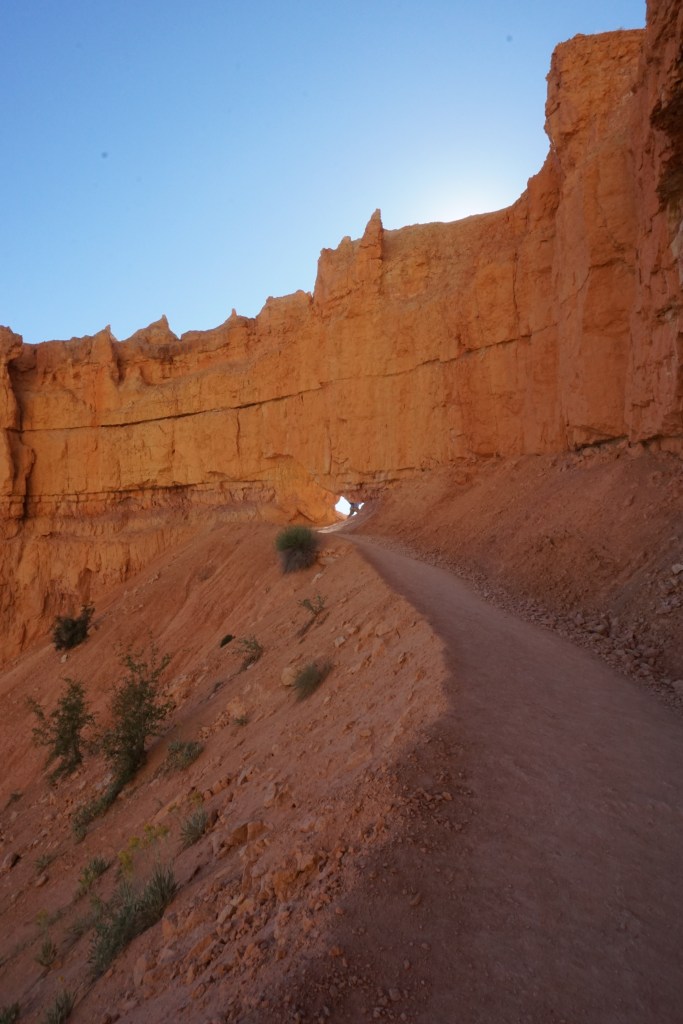
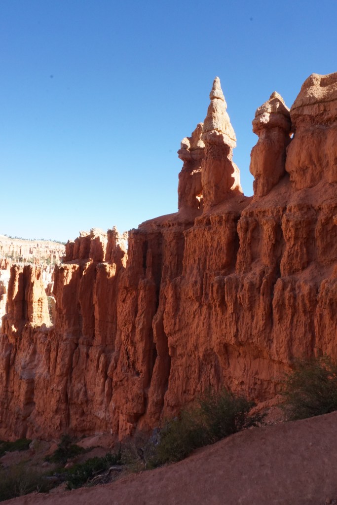
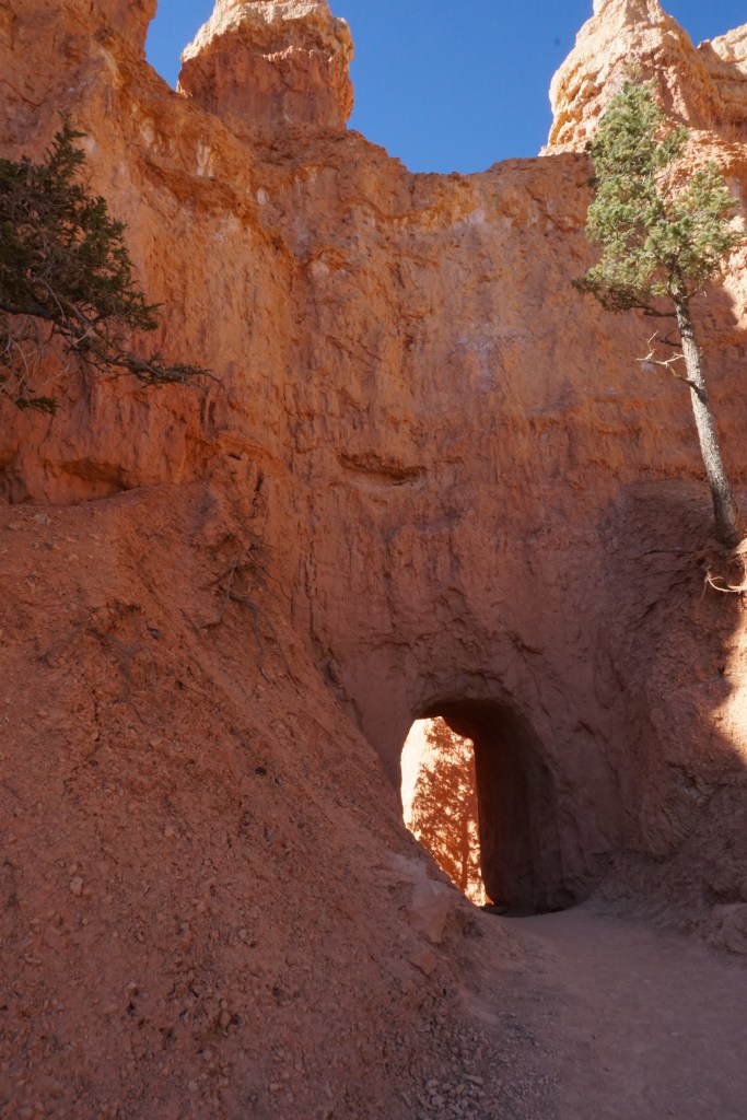
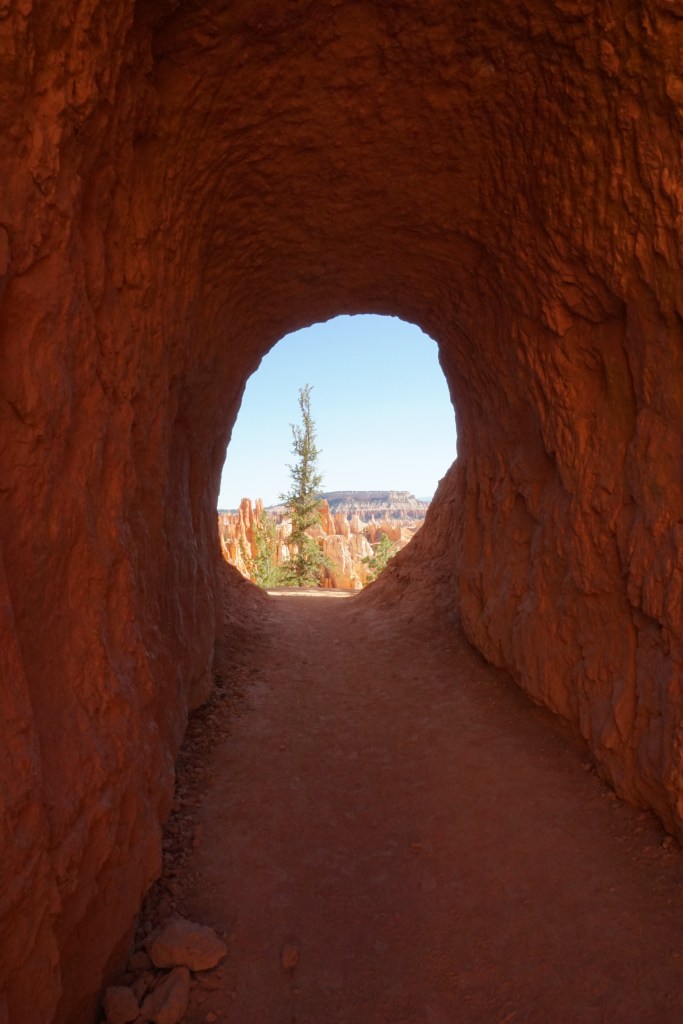
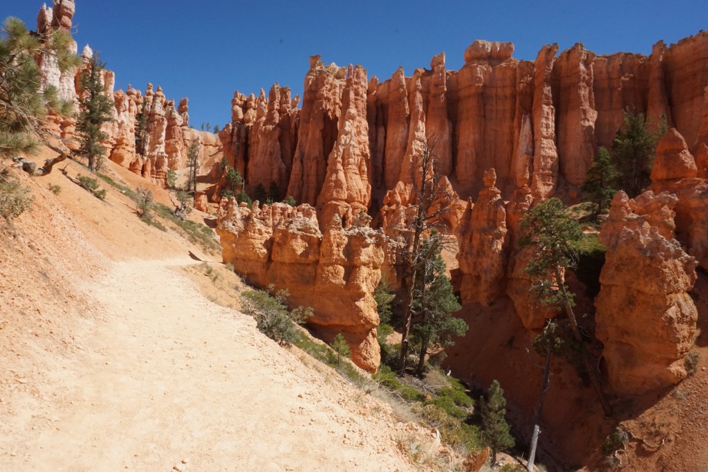
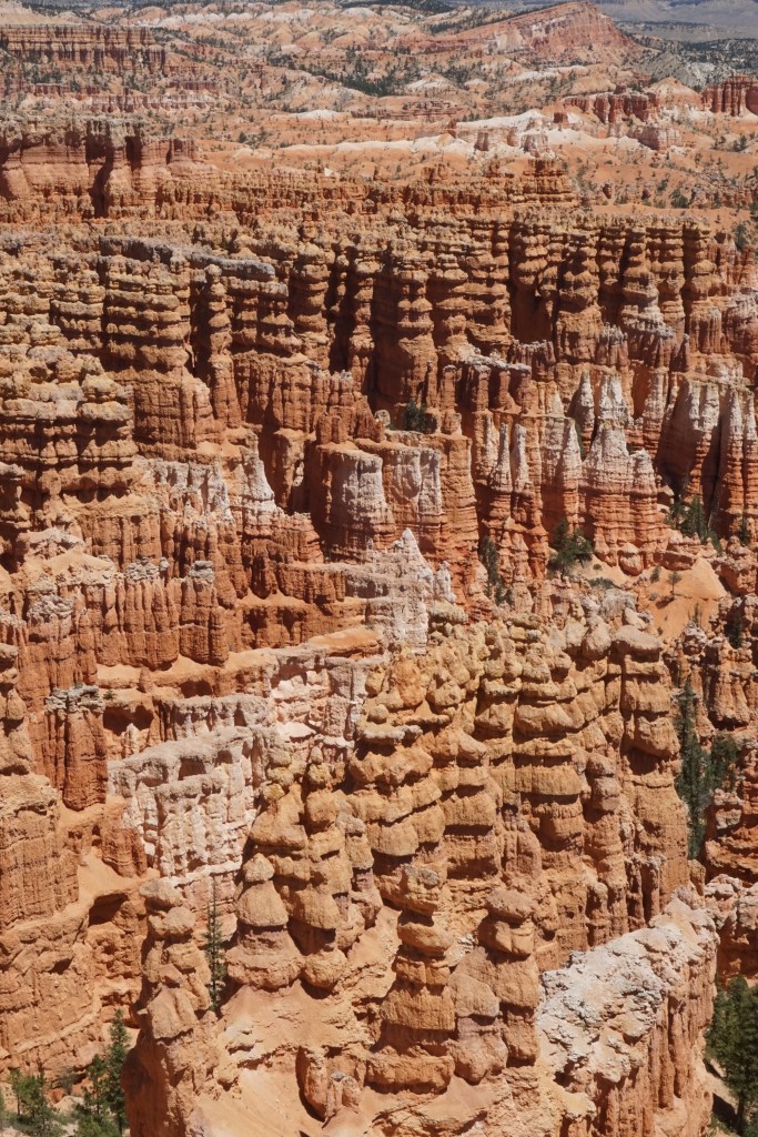
Bryce Canyon is one one of the last remaining places that I am revisiting from my family’s Big Family Road Trip Out West from when I was a kid, and unlike last time, this time I got to see it from the inside. One of the coolest hikes I’ve ever gone on was the Bryce Traverse, which starts at one side of the canyon rim, dips down and weaves through the “hoodoos” (the stone formations), and then comes up on the other side near the visitor’s center. Walking among, around, and sometimes even through the hoodoos was such a special way to experience the park; in fact at the end of the day I went to the ranger station to collect my prize for taking the “I hiked the hoodoos” challenge (yes I asked, it wasn’t just for kids!!) and the ranger was so stoked when I told her which trail I had hiked. The only sad part of the experience is that because the weather was so clear and the sun was so bright, a lot of my pictures are a little washed out or over bright (I am still getting the hang of this photography thing!)


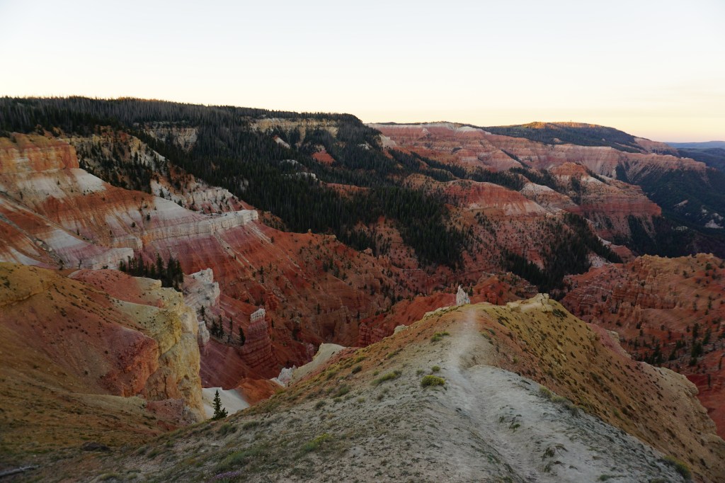
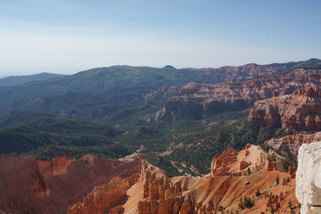
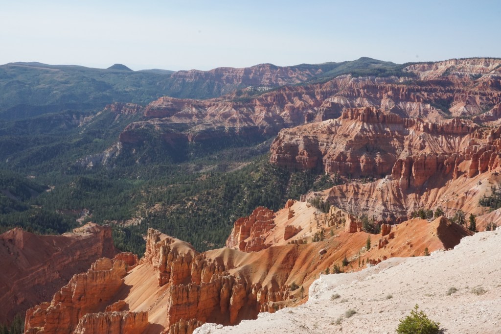
Cedar Breaks National Monument
Cedar Breaks is a place I might not have normally visited, except that for the first half of my time in Utah, I was staying just a few minutes away. The park sits at about 10,000ft above sea level, putting it at the top of the “Grand Escalante,” the giant geological staircase that starts here and steps its way down to the high desert in Arizona. It’s kind of like a baby Bryce Canyon (which is on the same “step” as Cedar Breaks), but without the crowds.


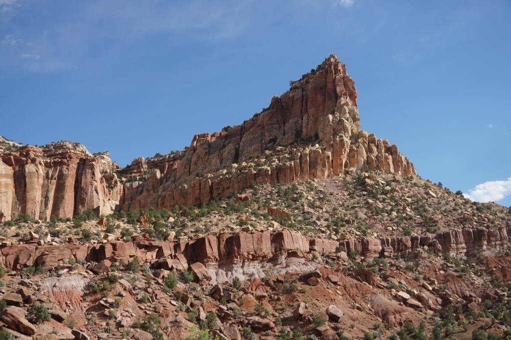
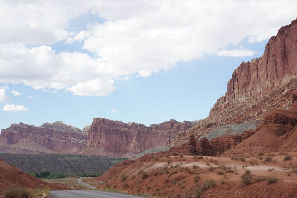
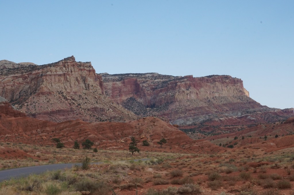
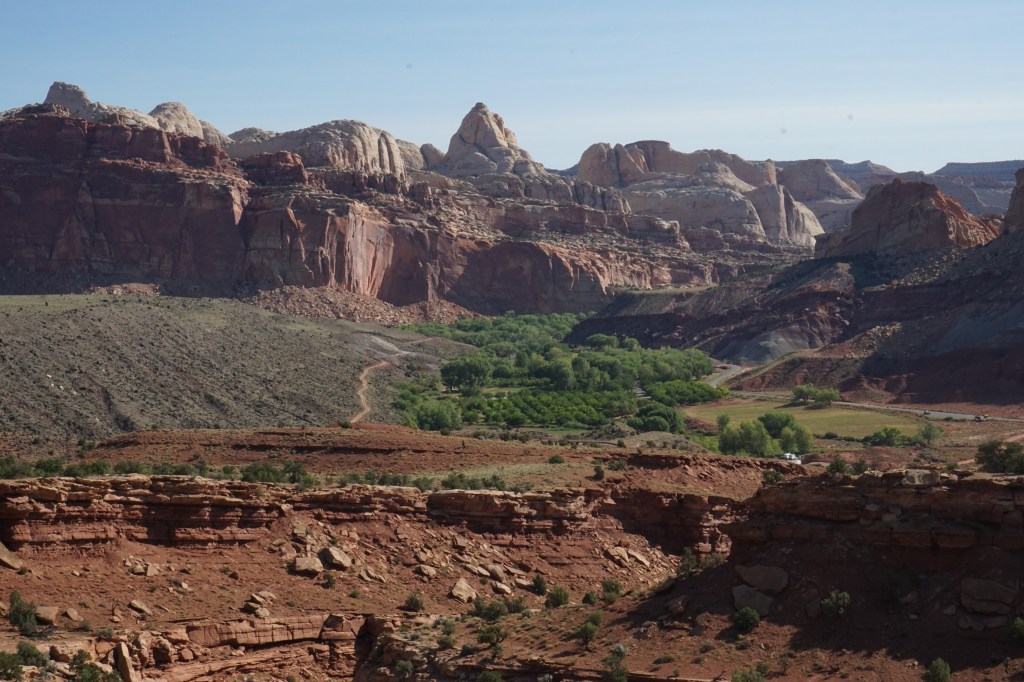
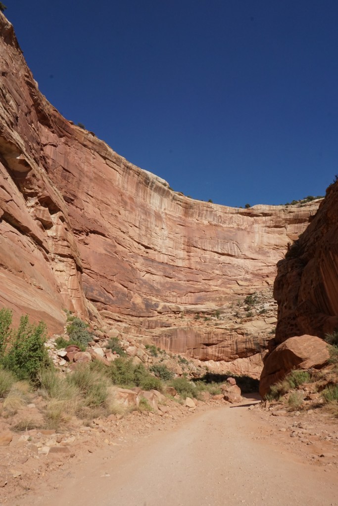
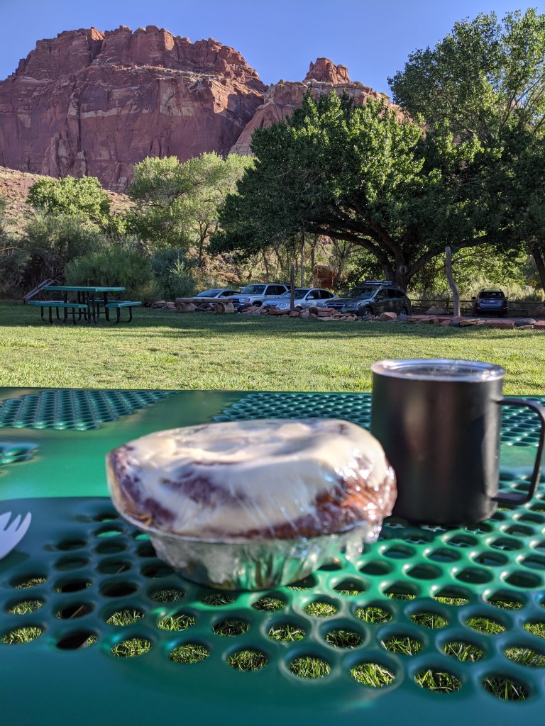
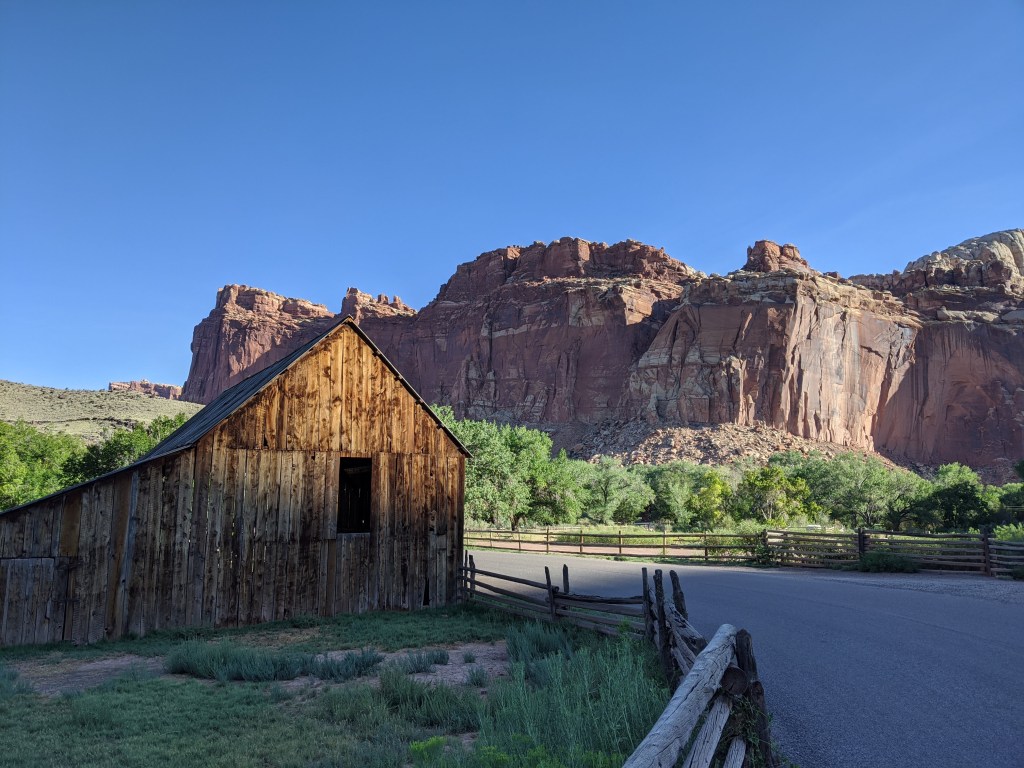
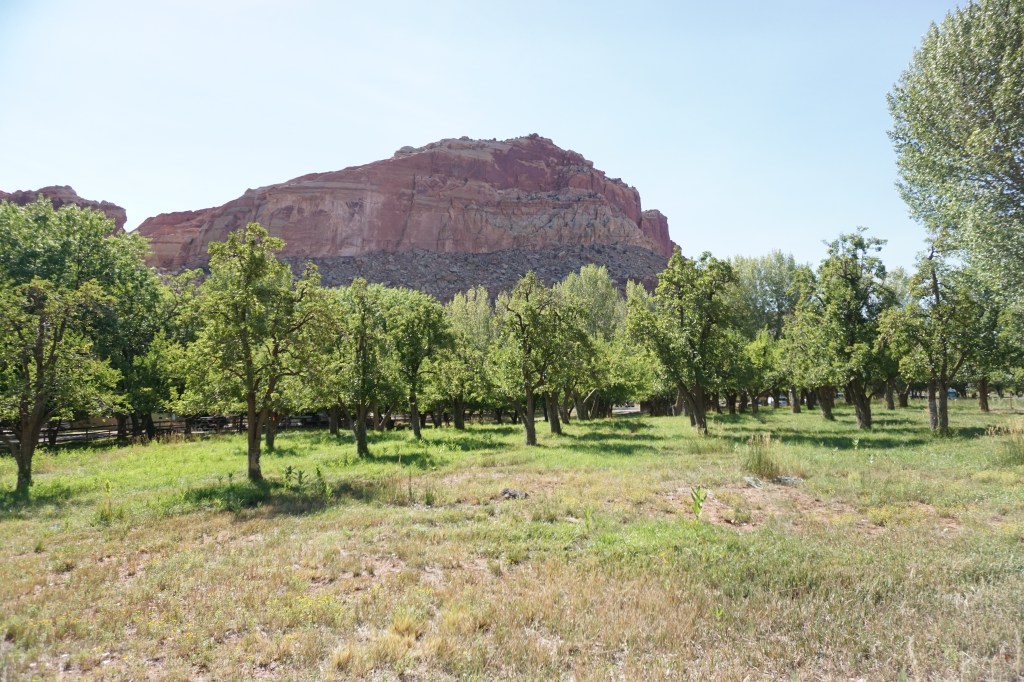
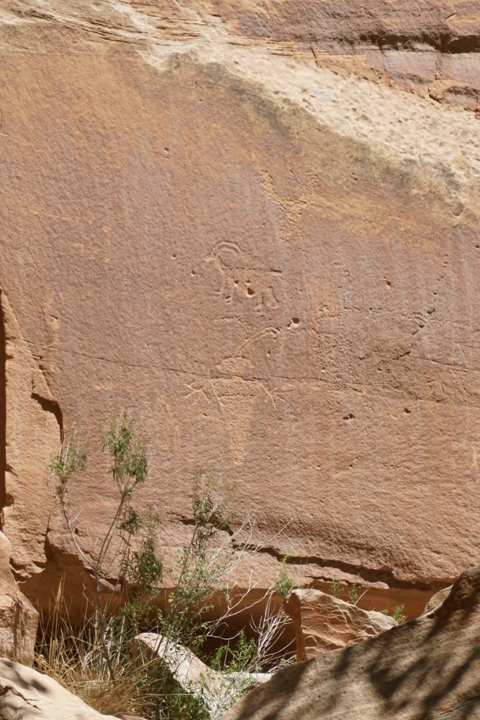
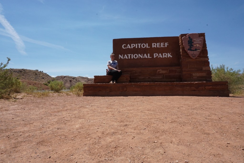
Capitol Reef National Park
I spent the first half of my time in Utah in the western part of the state visiting Zion and Bryce, and the second half in the eastern part visiting Arches and Canyonlands, and for the weekend in the middle I visited Capitol Reef NP. It’s also the only place in Utah that I camped, because for most of the time I was there it was too frigging hot to sleep in a tent in the desert. Capitol Reef has both breathtaking geologic beauty, and something like 10,000 years of human history. You can see ancient indigenous petroglyphs carved on the rocks, and pick the fruit from the orchards of an abandoned 19th century Mormon settlement. You can also get little fruit pies and massive cinnamon rolls from the farm too!


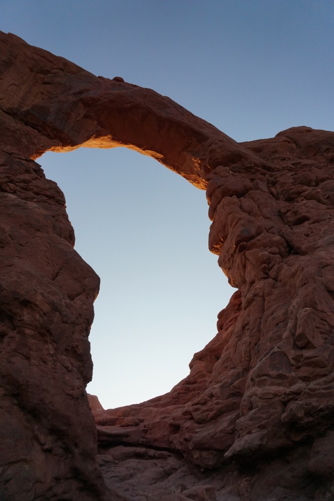
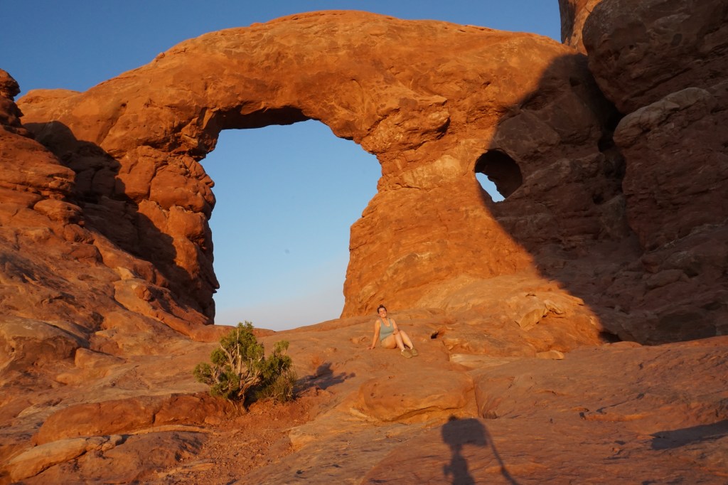
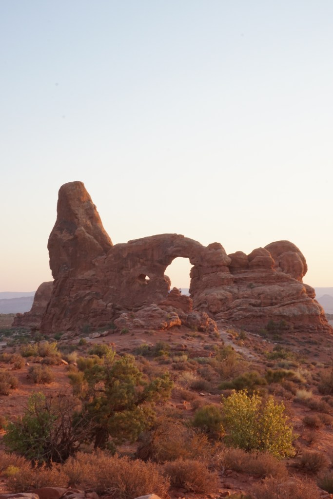
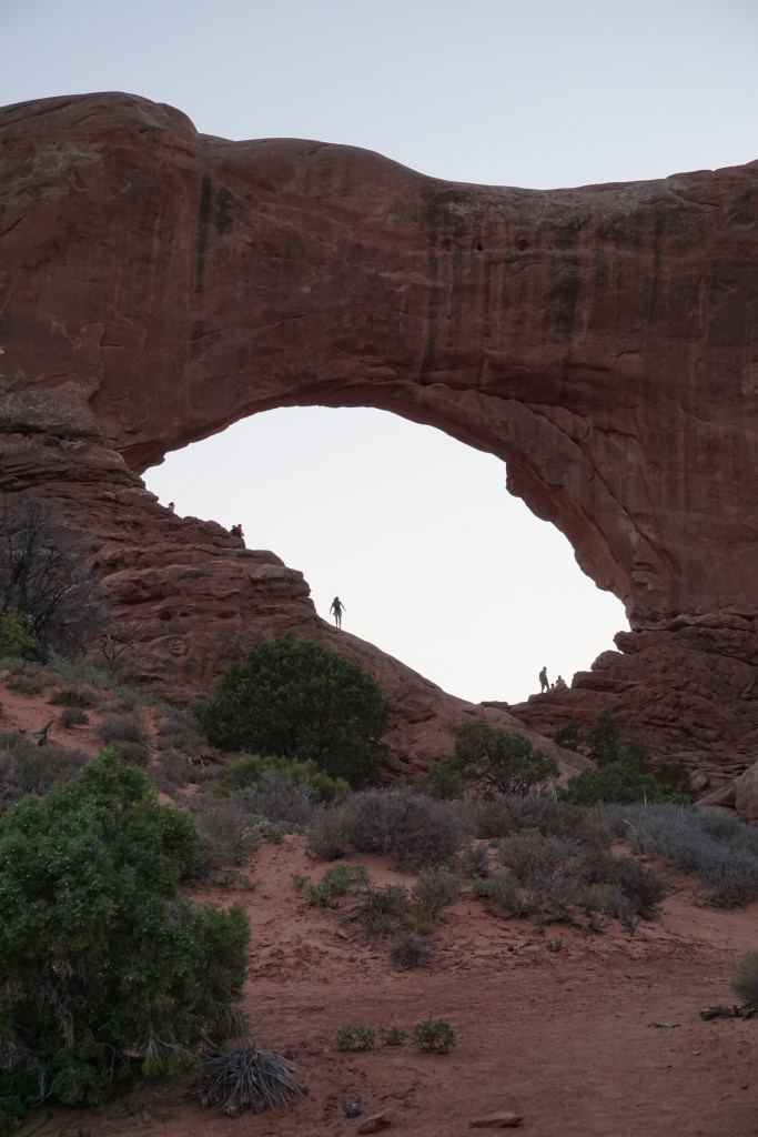
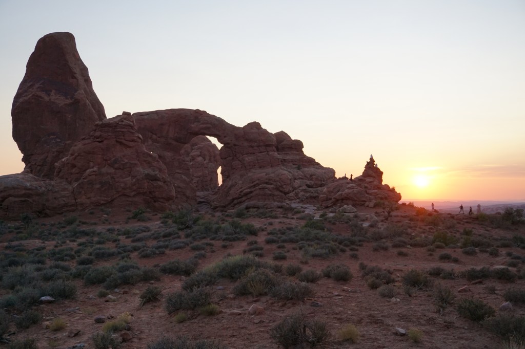
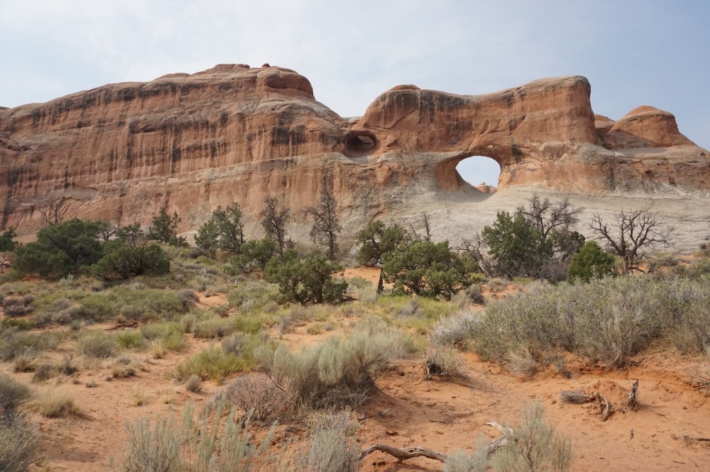
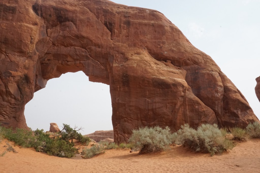
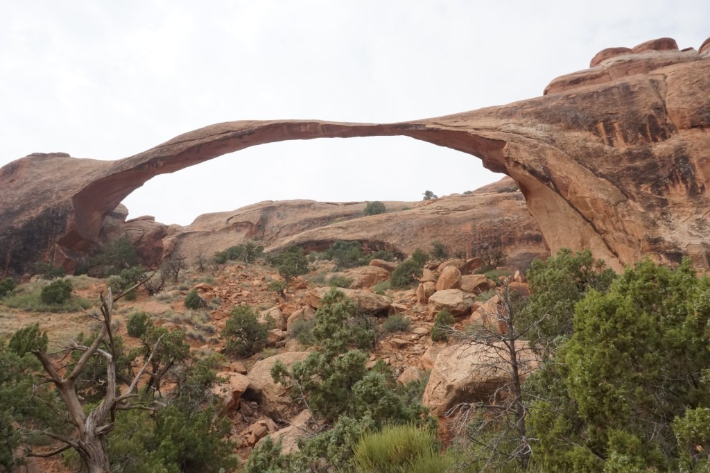
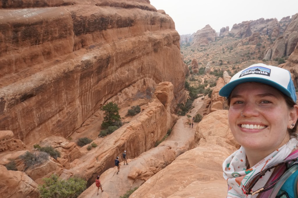
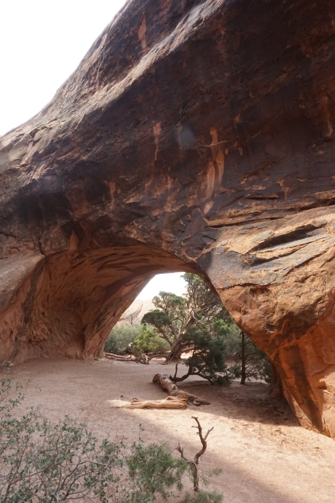
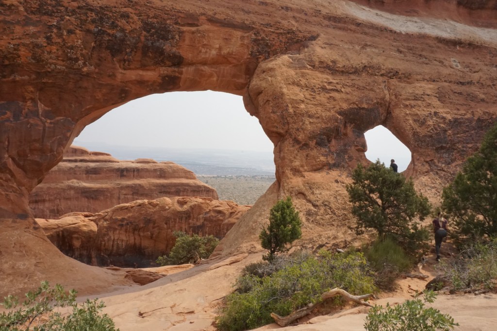
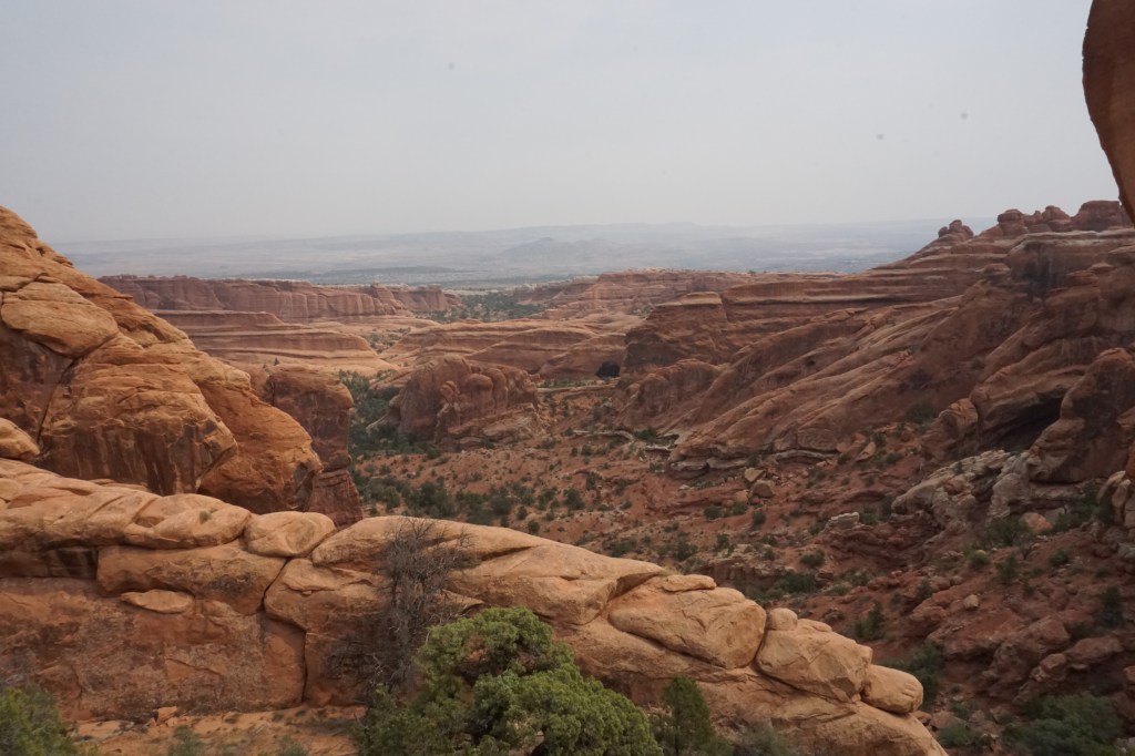
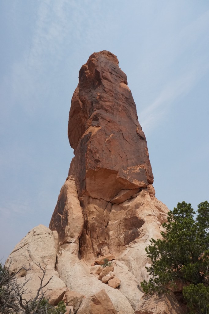
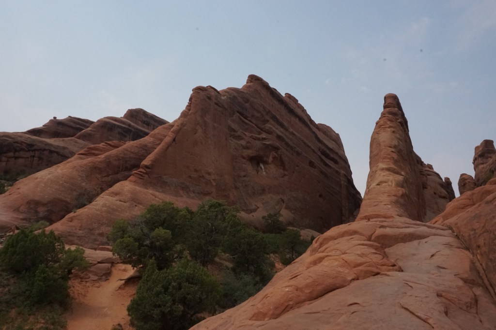
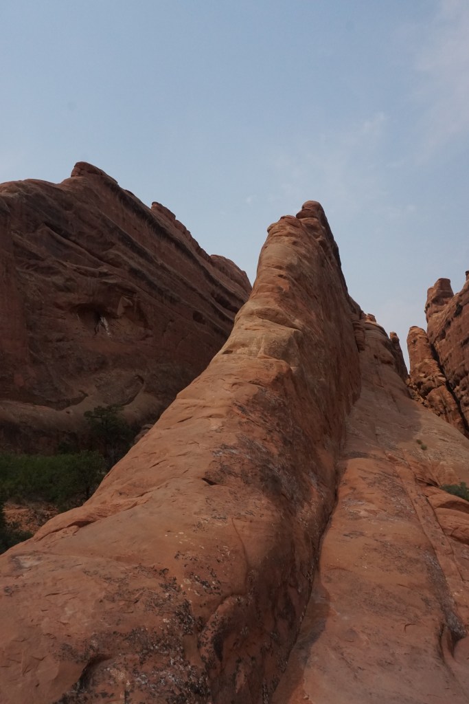
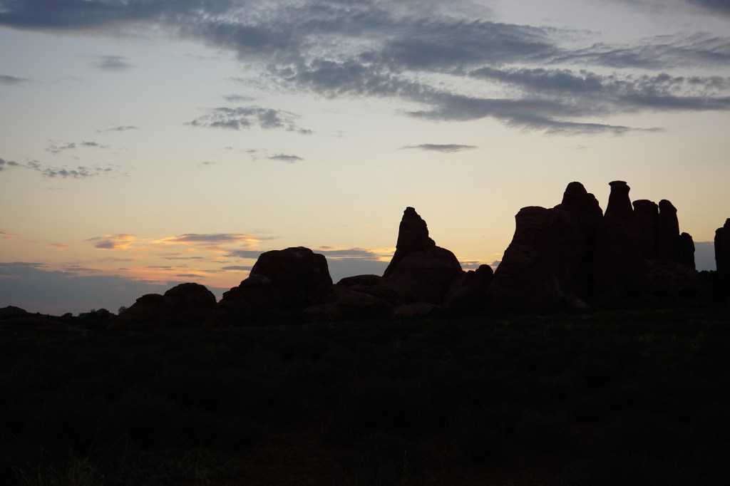
Arches National Park
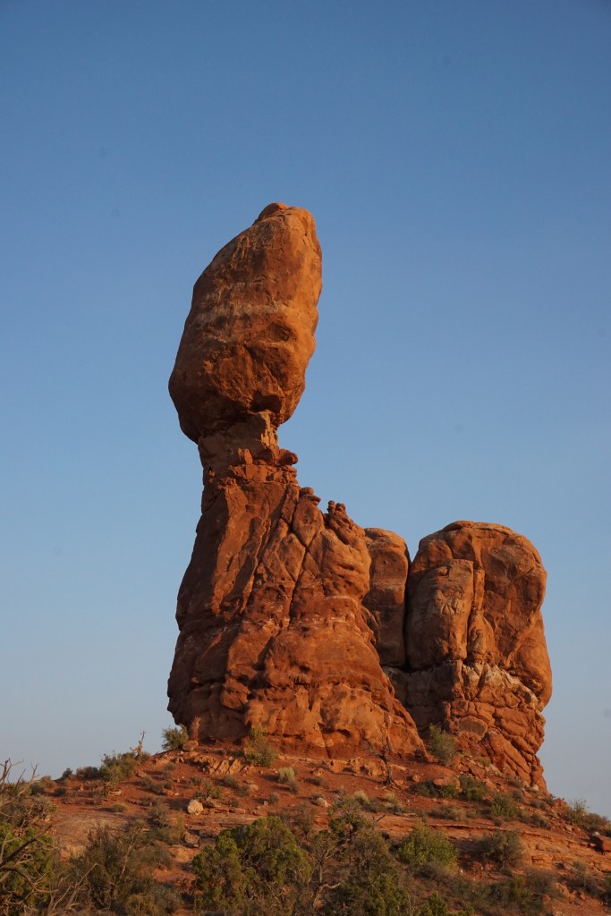
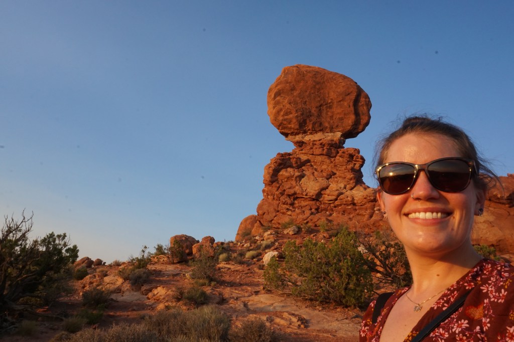
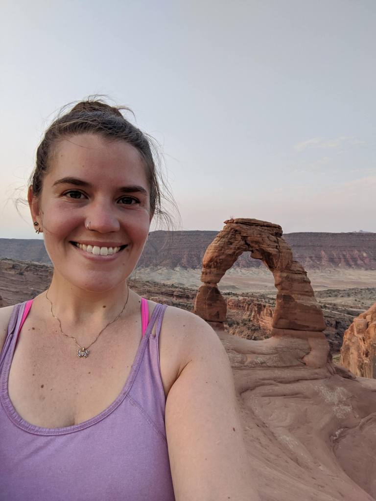
Arches might be the most famous of the parks in Utah, and with its distinctive stone formations it’s not hard to see why. The second half of my time in Utah I spent in Moab, only about a 15 minute drive to the entrance of Arches, so I spent quite a lot of time there, more than I spent in any of the other parks. Arches is one of those places that exists in the common consciousness, so I thought I had a good idea what it would be like, but I was surprised when I got there by both just how many arches there were, and how big they are. I think I had imagined Delicate Arch (the one on the license plate) as being like, the size of a door on a house; but in reality it’s as tall as a five storey building! In the photos below, the one after the close-up selfie of me in front of Delicate Arch is a shot of me standing underneath it – you can barely make out that I’m a person at all!


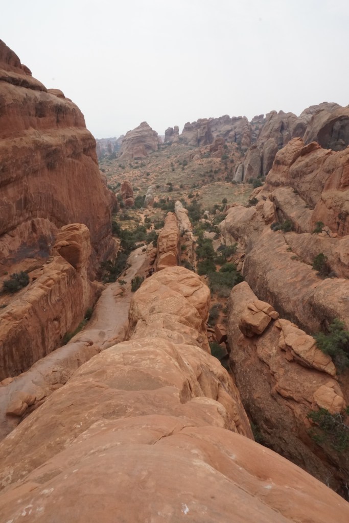


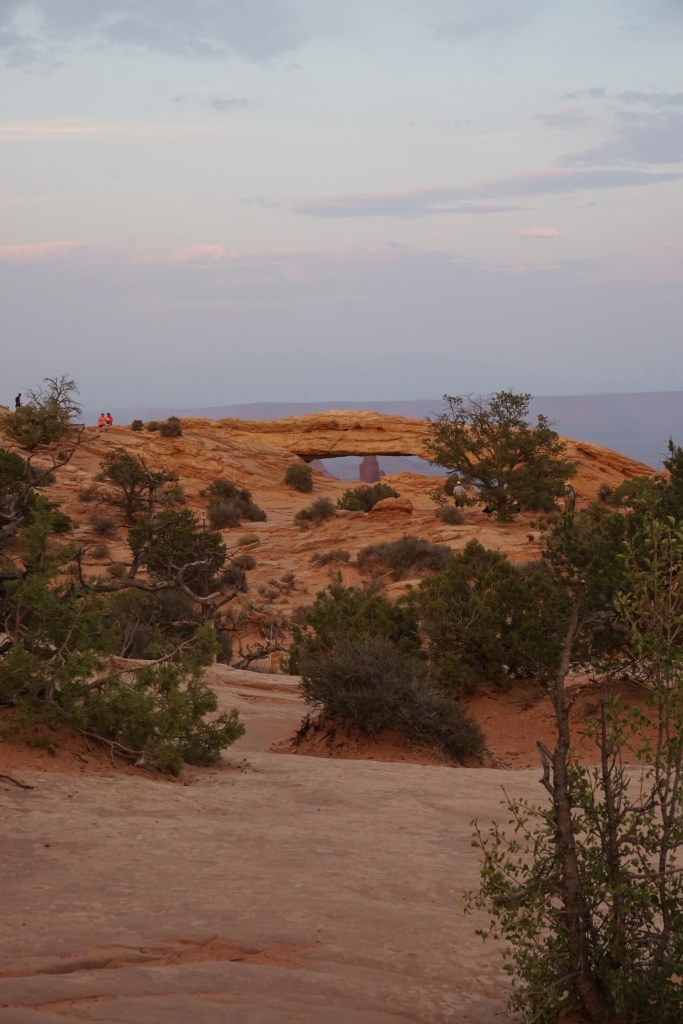
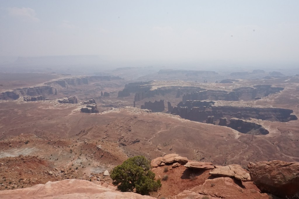
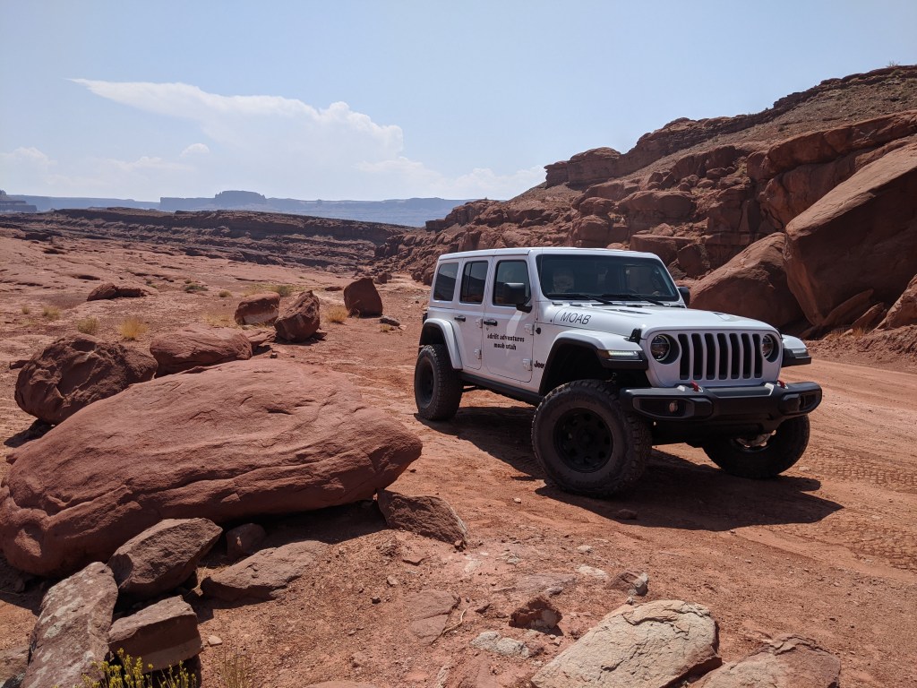
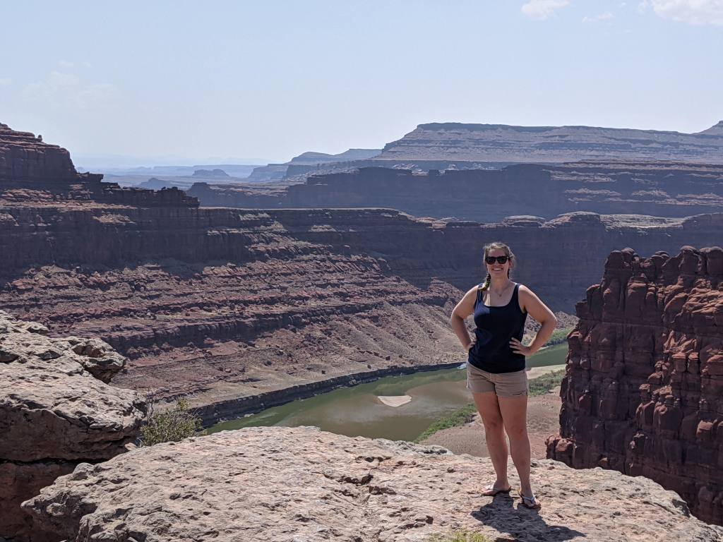
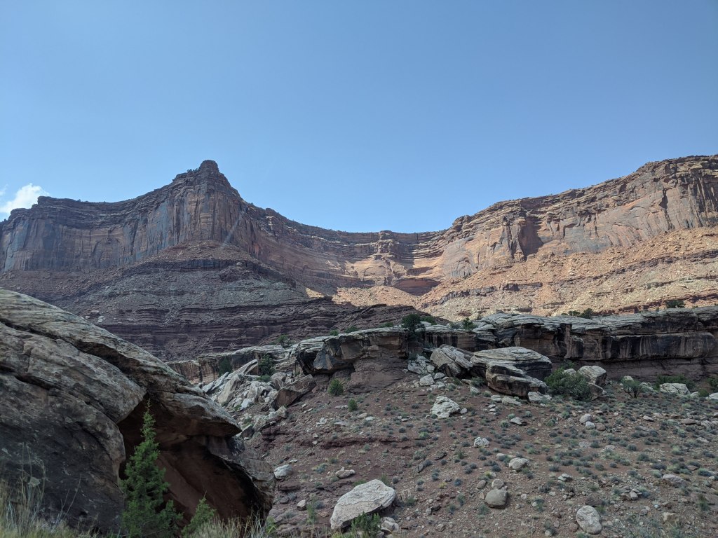
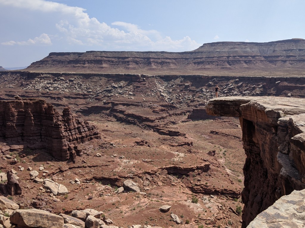
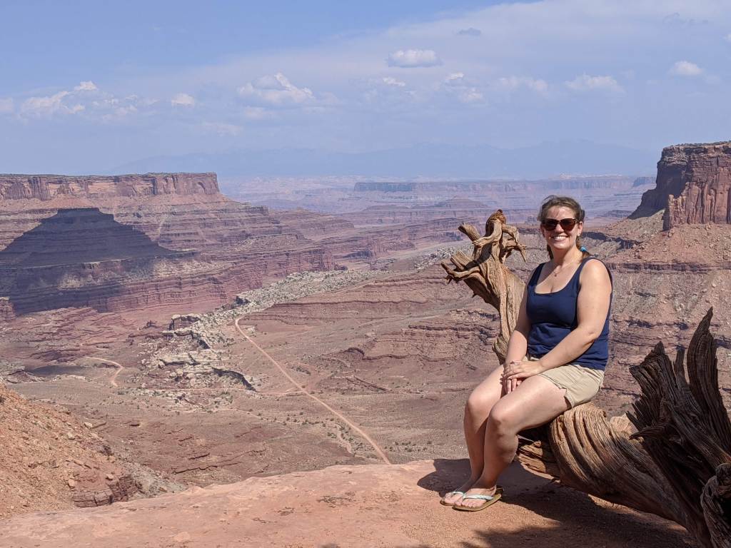
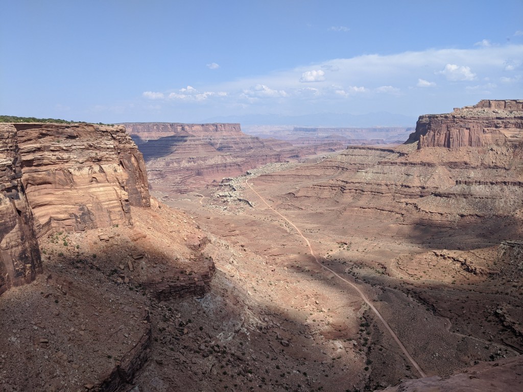
Canyonlands National Park
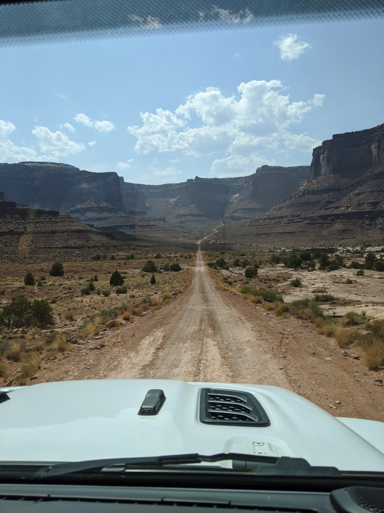
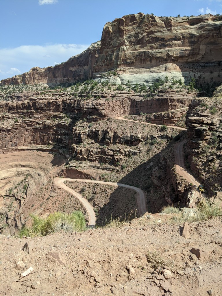
Canyonlands is a total sleeper national park. Despite being practically across the street from Arches, it gets way fewer visitors per year and is much less famous (except for that guy who cut his own arm off). I think a lot of the reason for that is because it’s also one of the most rugged; all of the parts of the park I was able to visit in my Mazda took me less than a whole day, but covered only like 5 or 10% of the whole park. Most of the park you need high clearance 4WD vehicles to get to. That’s why, for my birthday, I treated myself to a Jeep 4×4 trip of the backcountry with Adrift Adventures. We got to see the park from the bottom of the canyons looking up. The trip took us along the White Rim Road and up the famous Shafer Trail (see that zigzag road in the second photo below? That’s the road we drove up!)


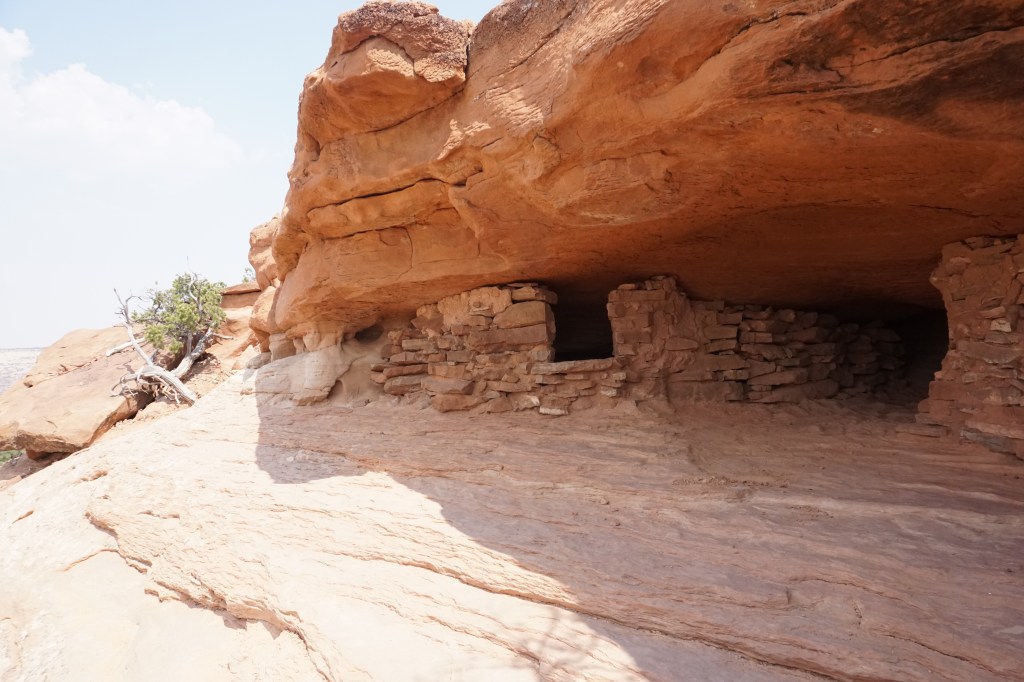


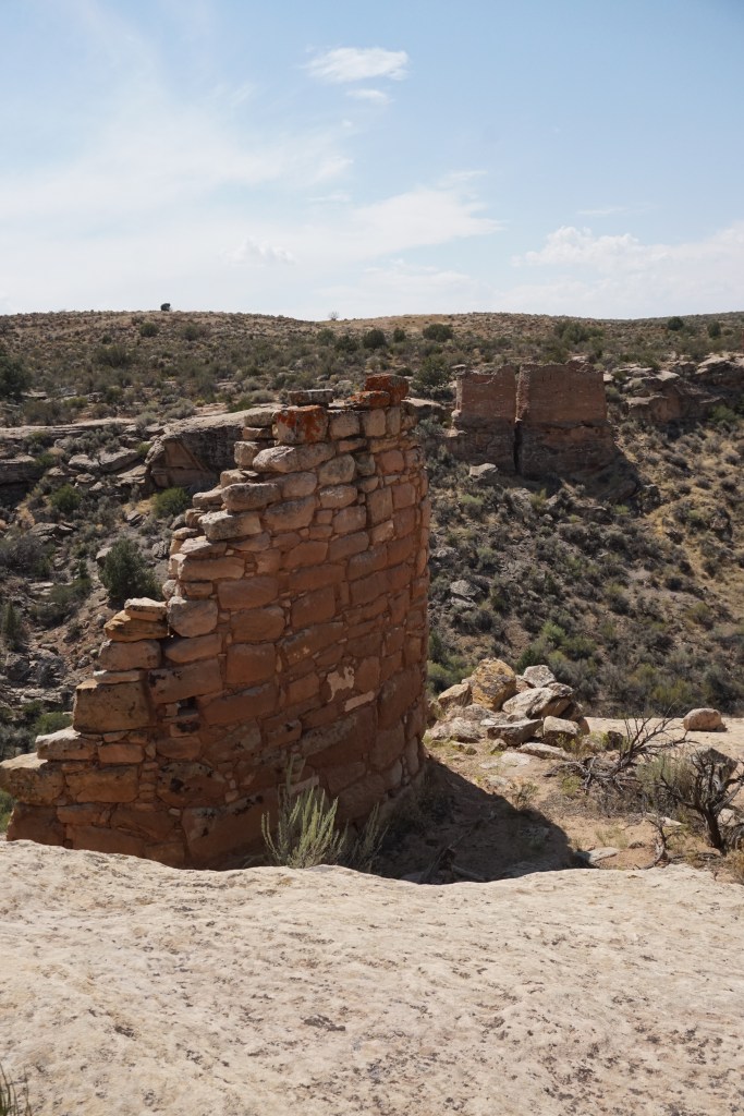
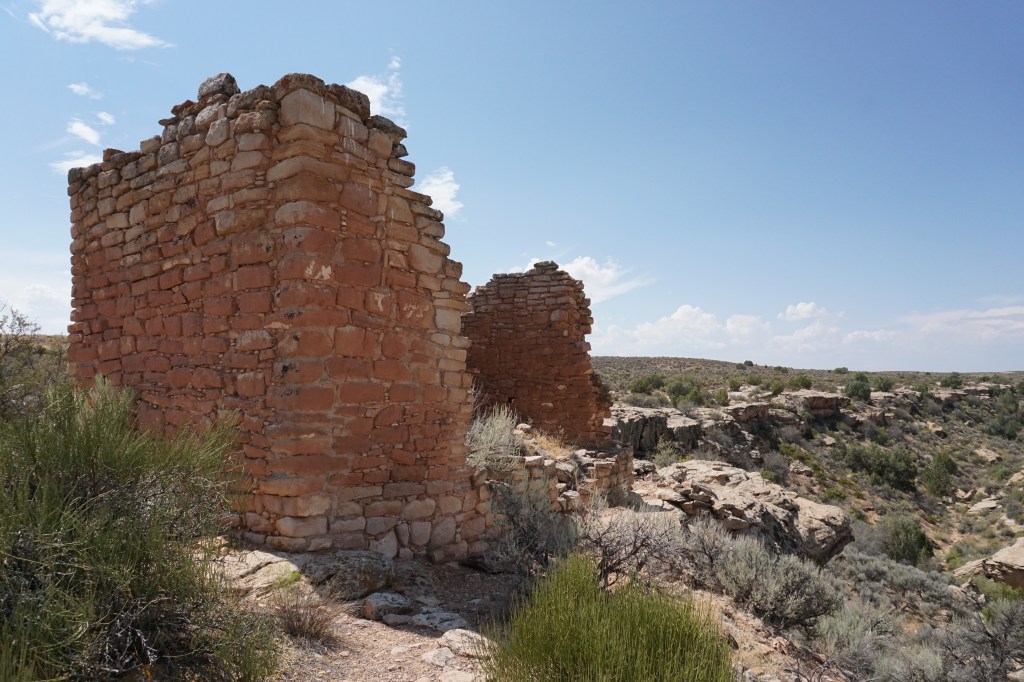
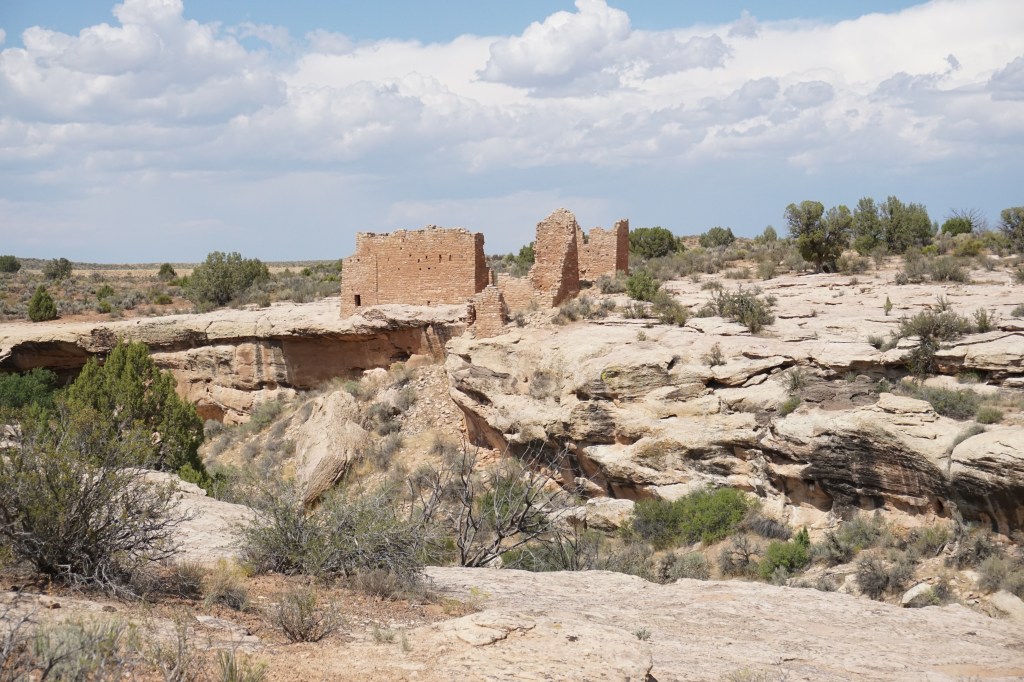
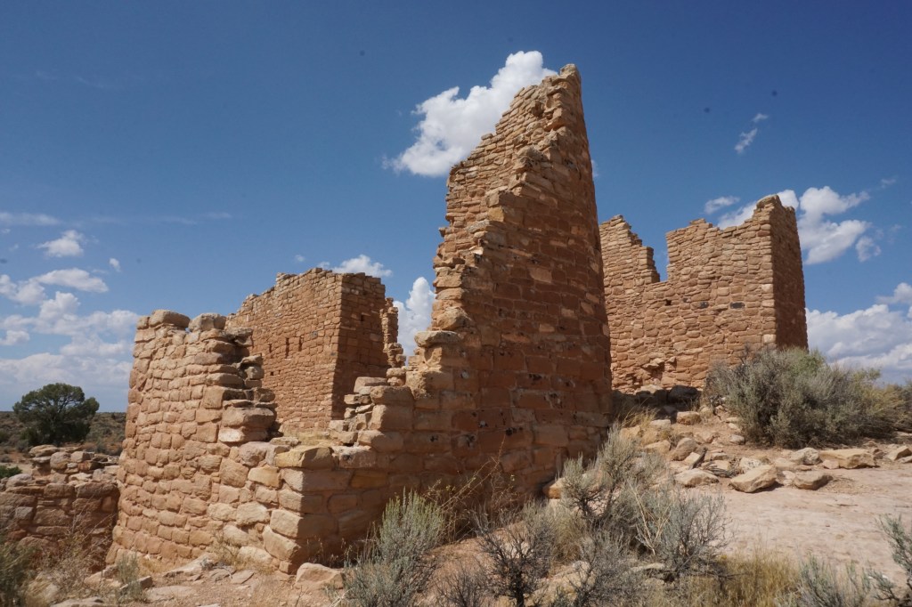
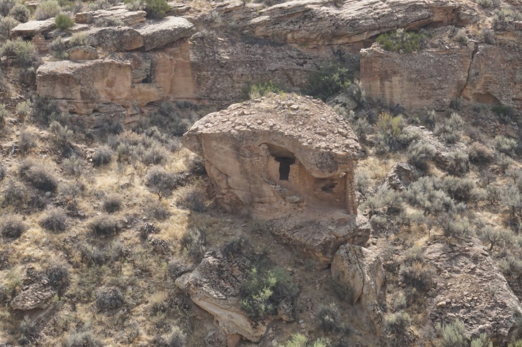
Hovenweep National Monument
Hovenweep National Monument preserves the ruins of a settlement of ancient Pueblo people. They lived here in around the 13th century CE and how they managed to do so in the bone-dry desert of southeast Utah is a mystery to me. I asked the ranger, “would it have been as dry then as it is now?” and she pointed to a couple trees in the distance and said “well those cottonwood trees probably wouldn’t have been there, and they’re taking some of the water out of the spring, but otherwise yes.” Think about that – this community lived on so little water that two cottonwood trees are able to drink pretty much all of it.


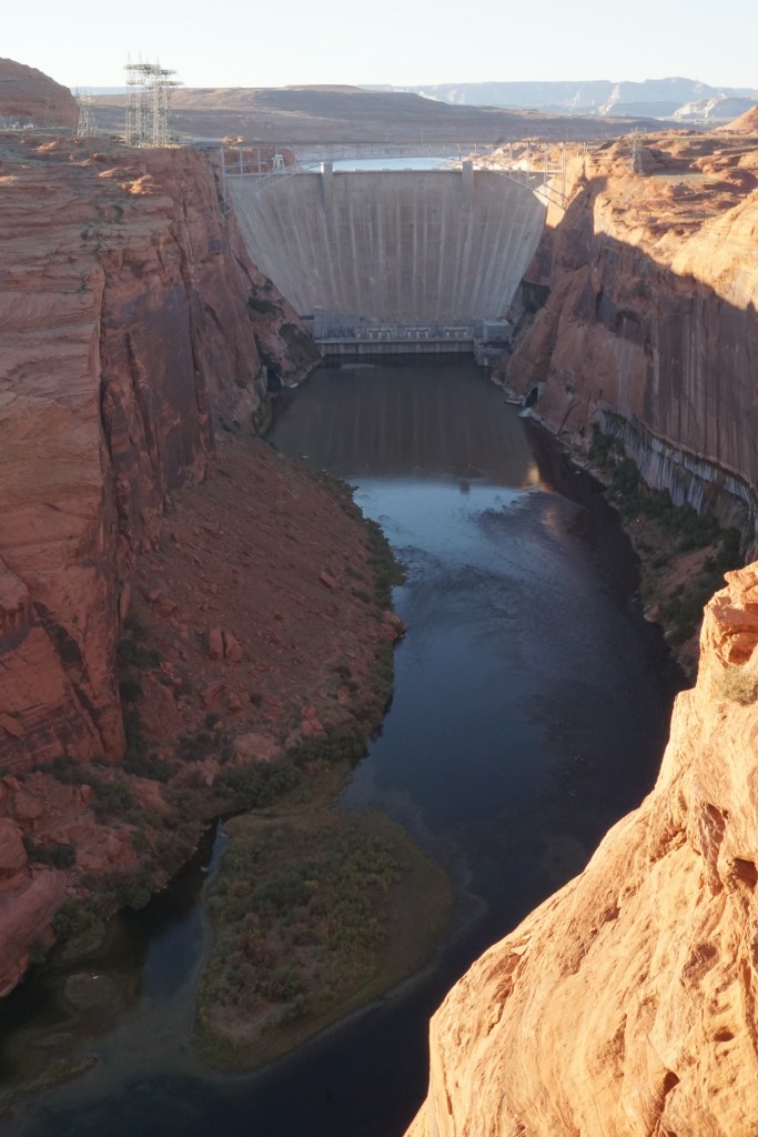
Page, Arizona – Glen Canyon and Horseshoe Bend
When I left Utah I was headed in the direction of Nevada, and Page, AZ seemed like a good place to stop for a few days en route. Unfortunately it ended up being one of my less successful stops. About half of the reason for that is because a lot more of the attractions in this area than I realized are within the boundaries of the Navajo Reservation, and at the moment all the tribal lands are locked down to outsiders (for extremely good reasons). That meant, for example, that all those Instagram-famous slot canyons were not an option. The other half of the reason is that I went to Page planning to do a fair bit of kayaking on Lake Powell, but the first time I attempted to put my kayak in the water, I discovered it had a hole and wouldn’t hold air. I then spent the rest of the week attempting multiple times to patch it, thinking I had gotten it, inflating it, and finding out it hadn’t worked. I considered buying a new one (it wasn’t expensive), but the store no longer has them in stock. Can’t win ’em all, I guess.


The photos in this page were taken on land belonging to Southern Paiute, Ute, Pueblo, Hopi and Navajo people.